Using custom maps

Customize the Hunt

Treasure Hunt uses the Open Street Map world map by default, which is suitable for navigating the real world. But this map can be enriched by adding "layers" of information that can be superimposed on the base map or completely replace the default cartography. 

Treasure Hunt's map manager allows for several mapping modes:

  1. Default map - Base map of the world: A street map or satellite image can be used. By default Treasurehunt works like this.
  2. WMS Overlay - Base map of the world with an overlay map chosen by the teacher: You can superimpose maps served by WMS-compliant servers (Web Map Service). This type of map is superimposed over the base map and can be hidden and displayed with the layer menu.
  3. Custom base map - Only a WMS map chosen by the teacher: By selecting "This is the only base layer", the map chosen by the teacher can not be hidden.
  4. Photo overlay - Any photograph or image file can be projected on the ground. An example of this use is the projection of a historical map over the actual terrain. The teacher must know exactly the coordinates of the two corners of the photo to be able to place it on the map.
  5. Non-geographic image: This game mode uses a still image with a set of "hot spots" where there aren't actually geographic coordinates but only areas marked on a background "poster".
Mobirise

Web Map Service (WMS) layers

WMS servers are specialists in providing maps to applications quickly and with the lowest download volume.
If you want to add interesting information for large areas (e.g. a country or the whole world) and with a high level of detail (lots of zoom) you will need to connect to a public WMS server.
A WMS service consists of two parts:
- A base URL like: http://servicios.idee.es/wms/copernicus-landservice-spain?
- Some parameters behind the ? sign: SERVICE=WMS&LAYER=CoperPanEuropean

Mobirise

Non-geographic overlay

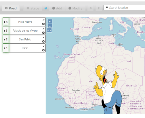
You can overlay any image on the base map. To do this, you have to upload the file (preferably a vector format such as SVG), set the "Layer type" parameter to "The image is rendered above the maps" and indicate the coordinates of the upper right and lower left corner for the overlay in the "Longitude west", "Latitude south", "Longitude east", "Latitude north" fields in geographic degrees.
Mobirise

Non-geographic base-map

Sometimes you want to do a Treasure Hunt on a "virtual map". Of course this cannot be done using the GPS, but it can be done using QR codes or playing "without moving" clicking with the mouse on the screen.
In this case you have to upload a suitable image (better in vector format to allow a good zoom with little file size) and set "Layer type" to "The image is not geographic".

Address

E.T.S.I. Telecomunicación
Univesidad de Valladolid
Paseo de Belén 13                     
Valladolid, 47011
Spain                    


Contact

Email: jpdecastro@tel.uva.es          

Links

E.T.S.I.T.
Install from Moodle directory


Feedback

Please send us your ideas, bug reports, suggestions! Any feedback would be appreciated.

Develop a web page with Mobirise